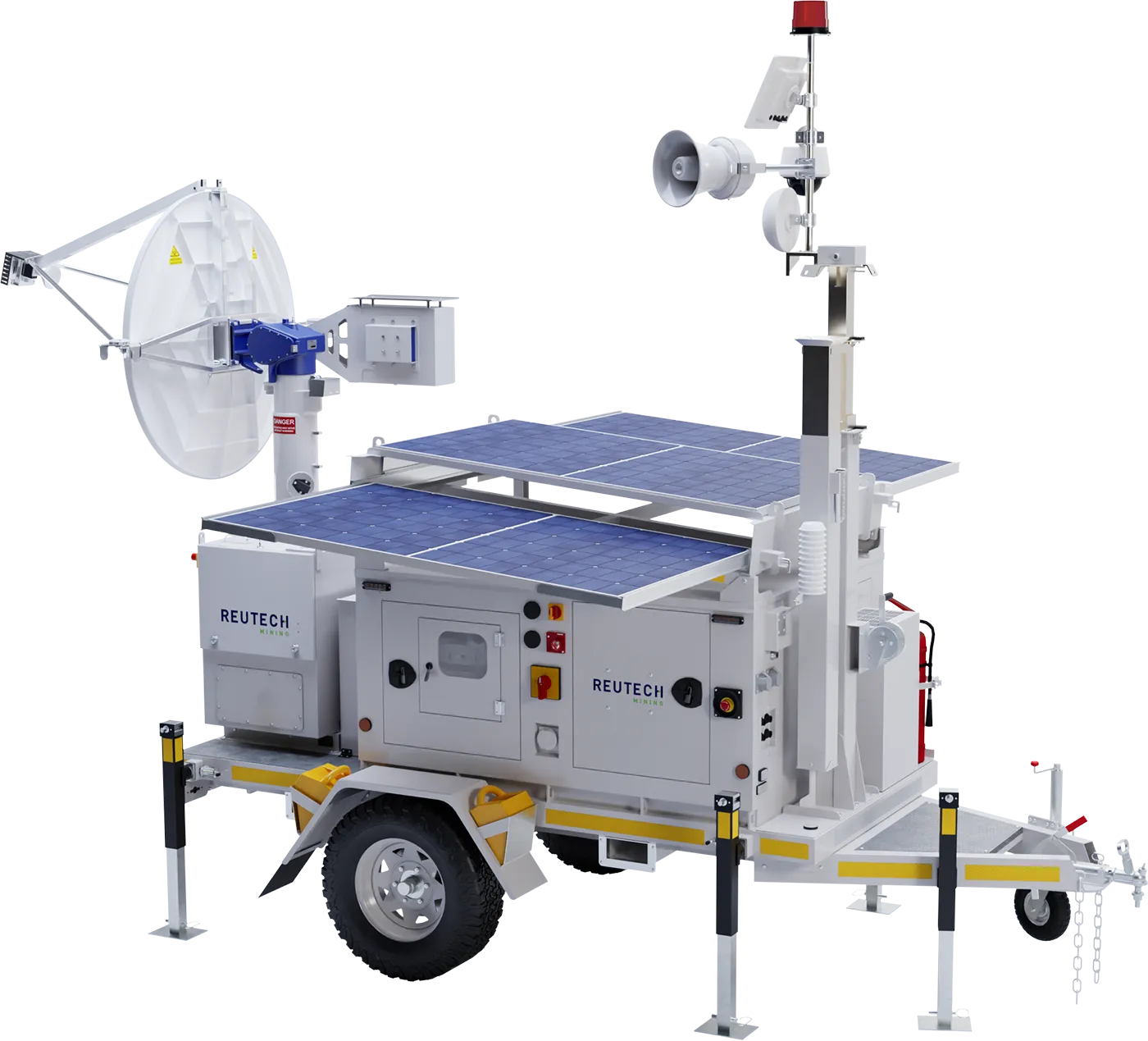
MSR Modular is Reutech Mining’s Real Aperture Radar (RAR) platform for strategic and tactical slope stability monitoring.
With configurable scan regions, multiple monitoring range options and flexible deployment, MSR Modular can be configured around the monitoring requirements of the operation. True 3D measurement, sub-millimetre measurement accuracy and monitoring ranges of up to 4,000 m provide geotechnical teams with accurate spatial and deformation data across changing monitoring requirements.
Open-pit monitoring requirements change as mining progresses. Areas of concern can shift, mine geometry develops and the distance and position between the radar and monitored slope can change over the life of a monitoring campaign.
MSR Modular provides flexibility across monitoring range, scan regions and deployment, allowing the monitoring approach to adapt as operational requirements change. Deployed on the Reutech Eco PSU, a greener solar-first power platform, it keeps continuous monitoring running wherever the radar is positioned.
For strategic monitoring, the radar can support longer-term monitoring where maintaining consistent deformation data over time is important for understanding slope behaviour and developing a historical monitoring database.
For tactical monitoring, configurable scan regions allow monitoring to focus on defined areas of concern where targeted deformation information is required.
The monitoring range, scan configuration and deployment can therefore be selected according to the specific requirements of the monitoring campaign.
MSR Modular uses Real Aperture Radar technology to measure slope deformation in three dimensions: range, azimuth and elevation.
The antenna movement limits are ±93° in azimuth and -37° to +92° in elevation.


The measured 3D point cloud enables MSR Modular to generate its own Digital Terrain Model (DTM) and position measured data accurately in three-dimensional space without requiring an external DTM for this purpose.
When the radar is georeferenced, these accurate 3D positions can be represented within the mine’s reference coordinate system.
This provides geotechnical teams with spatially positioned deformation data across range, azimuth and elevation for monitoring and interpretation.
MSR Modular is available with multiple monitoring range options, allowing the radar configuration to be selected according to the required monitoring distance.

MSR060
MSR120
MSR250
MSR400
30 m to 600 m
30 m to 1,200 m
30 m to 2,500 m
30 m to 4,000 m
98 ft to 1,969 ft
98 ft to 3,937 ft
98 ft to 8,202 ft
98 ft to 13,123 ft
98 ft to 1,969 ft
30 m to 1,200 m
98 ft to 3,937 ft
Configurable scan regions allow monitoring to be focused on the areas relevant to the monitoring campaign rather than applying the same scan configuration to every application.
Together, the available range options and configurable scan regions enable MSR Modular to support targeted strategic and tactical monitoring across different mine geometries and monitoring requirements.

Changing atmospheric conditions can influence radar measurements and need to be accounted for when monitoring slope deformation.
MSR Modular combines rapid data acquisition with an integrated onboard weather station and advanced atmospheric correction algorithms to account for atmospheric effects that may influence the deformation data.
This supports reliable deformation monitoring across changing environmental conditions.
Monitoring positions can change as mining progresses, access changes or the area of concern moves.
MSR Modular supports vehicle-mounted and fixed deployment configurations, as well as patented non-level deployment to within 15°, providing flexibility when selecting an appropriate monitoring position.
Where the radar needs to be repositioned during a monitoring campaign, georeferencing and Rapid Align™ support consistent spatial positioning and continuity of the monitoring database following redeployment.

MSR Modular supports both Auto Georeferencing and manual georeferencing, providing different methods for establishing the radar position within the mine’s reference coordinate system.
Auto Georeferencing uses high-accuracy GNSS positioning. Where available, positioning accuracy can be further improved through an RTK connection to the mine’s base station.
MSR Modular can also be manually georeferenced using total station survey control.
As mining progresses, the radar may need to be repositioned while monitoring of an existing area continues.
Rapid Align™ supports the re-alignment of scan regions after MSR Modular has been redeployed and georeferenced. This enables monitoring to continue within the existing monitoring database, supporting continuity of historical slope deformation data over time.
The resulting historical database can support review and back-analysis as the monitoring campaign develops.
MSR Modular is supported by MSR Solo, Reutech Mining’s software environment for MSR Modular and MSR Esprit 2.
MSR Solo supports the monitoring workflow, including system configuration, deformation visualisation, historical review and analysis, database management and alarm-region configuration.
Its Deployment Helper Tool can also be used to view and convert DTM files and visualise radar coverage from potential monitoring positions.
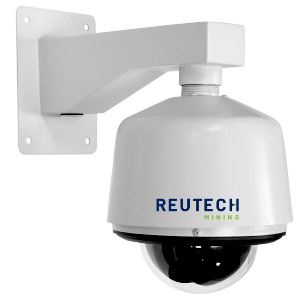
Where additional visual context is required, Slope Vision can complement MSR Modular by providing geo-referenced image and video information of the monitored area.
Slope Vision can slew to a geo-referenced area of concern, allowing monitoring teams to visually assess the relevant area while MSR Modular continues monitoring slope deformation.
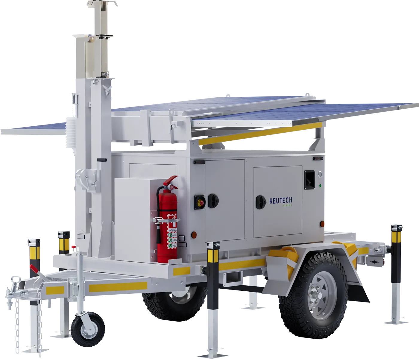
By drawing on integrated solar panels and lithium battery storage before the EPA 5 compliant backup generator is needed, the Eco PSU minimises engine runtime and reliance on diesel, providing a greener, more sustainable way to keep continuous radar monitoring running.
Hybrid energy supports reliable operation where monitoring positions are remote or site infrastructure is limited, with external AC charging available where site power can be accessed.
Remote access via mobile phone allows the power system to be checked without a site visit, reducing field intervention over the life of the monitoring campaign.
The common power architecture is designed to simplify fleet management, servicing, spares requirements, technician training and procurement across operations using different Reutech Mining radar platforms.
MSR Modular deployments can be supported by Reutech Mining’s Geotechnical Monitoring Centre (GMC) where additional monitoring capacity and continuity are required.
Dedicated monitoring personnel actively monitor slopes 24/7, review developing movement, warnings and alarms, and communicate pre-emptively with the mine as conditions evolve.
Monitoring and escalation are carried out in accordance with the agreed monitoring process and the mine’s established TARP, extending monitoring capacity while operational and legal responsibility remains with the mine.
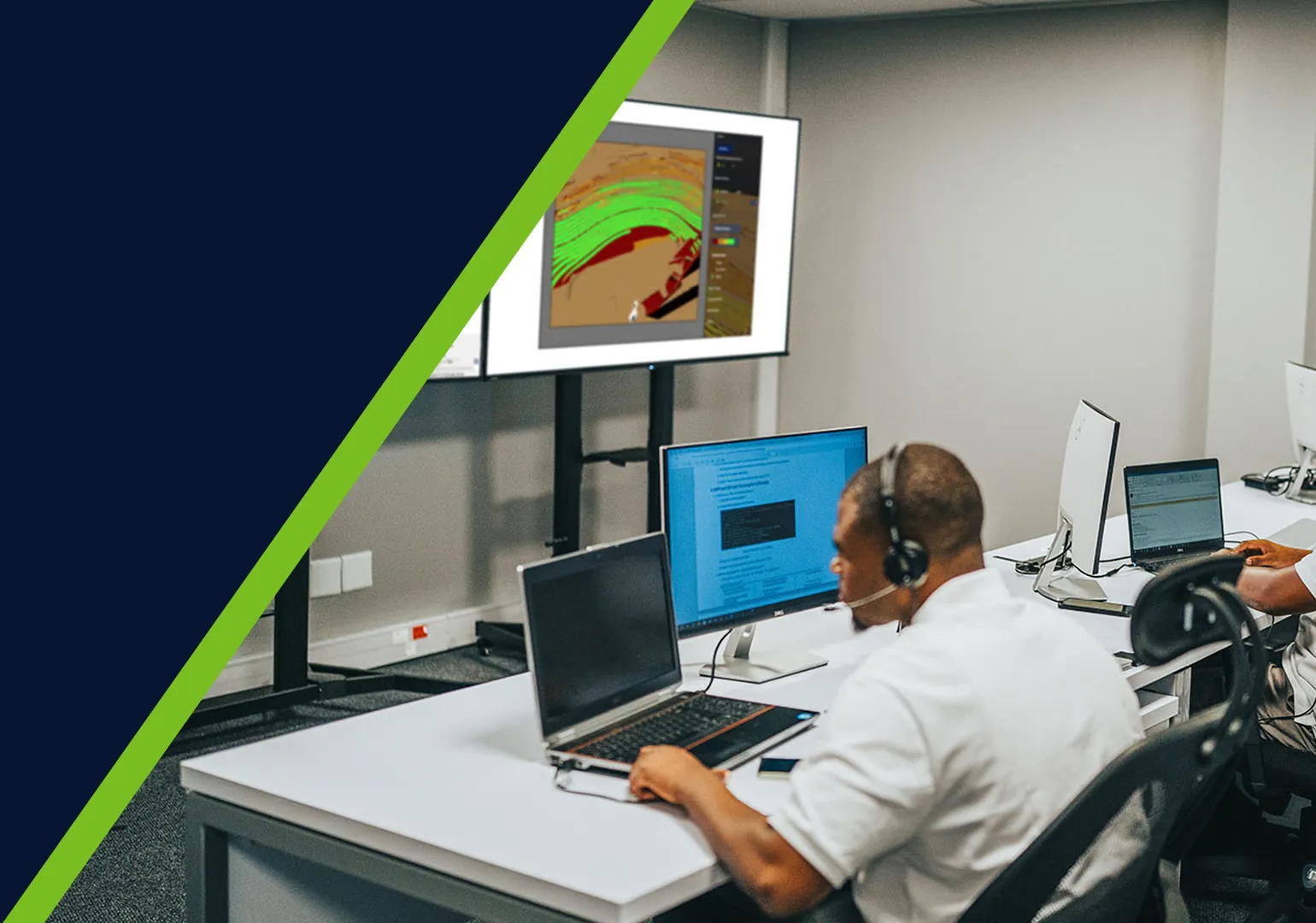
MSR Modular forms part of Reutech Mining’s Complete Custom Radar Monitoring Solution, where the radar platform, deployment, software, power, monitoring support and technical services can be configured around the requirements of the operation.
The wider Reutech capability allows the supporting elements of the monitoring solution to be selected around the requirements of the operation, while MSR Modular remains the Real Aperture Radar platform at the centre of the deployment.
MSR Modular is supported throughout its operating life through system-health visibility, remote diagnostics, maintenance support and technical assistance.
Real Aperture Radar (RAR)
Azimuth: ±93°
Elevation: -37° to +92°
True 3D measurement in range, azimuth and elevation
Range: 0.5 m
Azimuth: 4.4 m
Elevation: 0.44 m
Sub-millimetre
MSR060: 30m to 600m
(98ft to 1969ft)
MSR250: 30m to 2500m
(98ft to 8202ft)
MSR120: 30m to 1200m
(98ft to 3937ft)
MSR400: 30m to 4000m
(98ft to 13123ft)
MSR060: 30m to 600m (98ft to 1969ft)
MSR120: 30m to 1200m (98ft to 3937ft)
MSR250: 30m to 2500m (98ft to 8202ft)
MSR400: 30m to 4000m (98ft to 13123ft)
Standard: -30°C to +55°C (-22°F to 131°F)
Low-temperature kit: -50°C to +55°C (-58°F to 131°F)
Up to 110 km/h (68 mph)
0% to 100%
Onboard data processing
More than one month of onboard data storage
Automated backup to a central server
Integrated onboard weather station with advanced atmospheric correction algorithms
Integrated onboard weather station with advanced atmospheric correction algorithms
Vehicle-mounted
Fixed deployment
Patented non-level deployment to within 15°
Eco PSU: solar-first hybrid with lithium battery storage and EPA 5 compliant backup generator
External AC charging input
Auto Georeferencing using high-accuracy GNSS positioning
RTK connection to the mine’s base station where available
Manual georeferencing using total station survey control


MSR Modular can support both strategic and tactical slope stability monitoring. For strategic monitoring, it can support longer-term monitoring where maintaining a consistent deformation database is important. For tactical monitoring, configurable scan regions allow monitoring to focus on specific areas of concern. The monitoring range, scan configuration and deployment are selected according to the requirements of the monitoring campaign.
MSR Modular combines configurable scan regions, multiple monitoring range options and flexible deployment. As mining progresses or the monitoring position changes, the radar can be redeployed and georeferenced, while Rapid Align™ supports re-alignment with previously monitored regions and continuity within the existing monitoring database.
MSR Modular measures in range, azimuth and elevation, producing a measured 3D point cloud. This enables the radar to generate its own Digital Terrain Model (DTM) and position measured data accurately in three dimensions. When georeferenced, these positions can be represented within the mine’s reference coordinate system.
MSR Modular uses rapid data acquisition together with an integrated onboard weather station and atmospheric correction algorithms to account for atmospheric effects that can influence radar measurements. This supports reliable deformation monitoring across changing environmental conditions.
Monitoring requirements differ according to mine geometry, monitoring distance, areas of concern, deployment conditions and the objectives of the monitoring campaign.
Speak to Reutech Mining about configuring MSR Modular for your strategic or tactical slope stability monitoring requirements.